Terremoto di magnitudo 6.7 al largo Indonesia orientale
epa10397124 A handout shakemap made available by the United States Geological Survey (USGS) shows the location of a 7.6-magnitude earthquake in the Banda Sea, off the coast of Indonesia's Tanimbar Islands Region and East Timor, early 10 January 2023. According to Indonesia's Meteorology, Climatology, and Geophysical Agency (BMKG), the earthquake struck at 00:47:34 am Western Indonesia Time (WIB) (17:47:34 pm UTC) on 10 January, and was centered in the Banda Sea at a depth of 131km. EPA/USGS HANDOUT HANDOUT EDITORIAL USE ONLY/NO SALES
AA
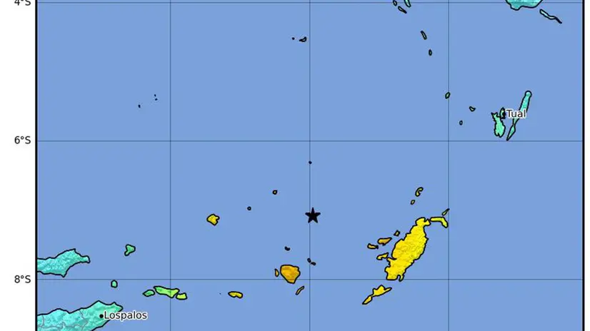
ROMA, 14 LUG - Una scossa di terremoto di magnitudo 6.7 è stata registrata oggi al largo dell'Indonesia orientale: lo riporta l'Istituto geofisico statunitense Usgs. Il sisma è stato localizzato a 179 km a sud-ovest di Tual, ad una profondità di 65.7 km. Non si segnalano per il momento allarmi tsunami.
Riproduzione riservata © Giornale di Brescia
Iscriviti al canale WhatsApp del GdB e resta aggiornato
Argomenti